HoudahGeo 5.4.2 / 6.0.1
HoudahGeo is a photo geocoding and geotagging tool. It tags photos with location coordinates and names.
HoudahGeo is used by travelers and professionals alike. Some use location information to organize and find photos. Others need to add GPS coordinates to photos in order to assess roadwork damages, to record wildlife sightings or to document environmental damages.
HoudahGeo writes EXIF, XMP and IPTC geotags to JPEG, RAW, and XMP sidecar files. Just like a GPS-enabled camera, HoudahGeo records latitude, longitude, and altitude information right to your image data file. Don't have a GPS device? No problem! Just drop a pin on the map where you took your photo and HoudahGeo will tag it with the correct location. HoudahGeo is the only application that can both write future-proof GPS tags to original images and add locations to photos in the Apple Photos, iPhoto, and Aperture libraries.
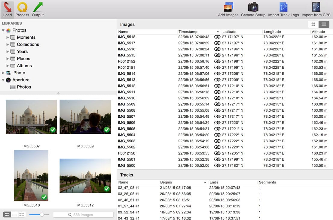
Geotagging with HoudahGeo follows an easy 3-step workflow: load, process, and then output.
- Start by loading photos into a HoudahGeo project. Optionally add GPS track logs
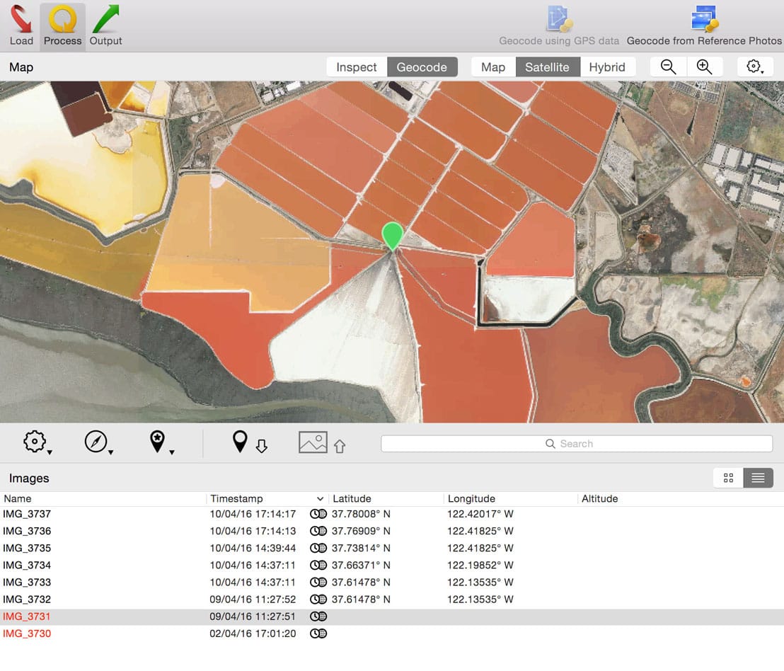
- Use the built-in map to assign or adjust photo locations. Use reverse geocoding to add city, state / province and country names
- Write location information to the original image files. Export the project for viewing in Google Earth or Google My Maps. Upload to Flickr
- Automatic geocoding using GPS track logs
- Geocoding using reference photos taken using iPhone or a GPS camera
- Geocoding without a GPS. Use the built-in map to double-check, adjust, or assign locations to your photos
- Reverse geocoding fills in city, state / province and country names
- Writes GPS data, location names, title, description and keywords to EXIF, XMP and IPTC tags
- Works with JPEG as well as a large number of RAW file formats. It also supports JPEG+RAW pairs as well as XMP sidecar files.
- Integrates with Apple Photos, iPhoto, Aperture, and Adobe Lightroom Classic
- Notifies Apple Photos (2.0 or newer), iPhoto, or Aperture when places information has been updated
- Create Google Earth KML and KMZ files. View photos "pinned" along the path travelled
- Publish photos and KML files to Dropbox. Share images on a map
- Upload geotagged photos to Flickr
What's New:
Version 6.0.1:Note: HoudahGeo 6.0 is a paid upgrade from previous versions
- Fixes a problem with importing the current selection from Apple Photos on macOS Catalina
- Fixes a problem where HoudahGeo would fail to notify Apple Photos and show an error message
- Fixes a problem where the geocoding pin on MapBox maps could not be dragged
Screenshots:
- Title: HoudahGeo 5.4.2 / 6.0.1
- Developer: Houdah Software
- Compatibility: macOS 10.14.0 or later, 64-bit processor
- Language: English
- Includes: K'ed by HCiSO
- Size: 46.23 MB
- visit official website
Users of Guests are not allowed to comment this publication.